Reading the Landscape: How to Experience the UNESCO Vredefort Dome World Heritage Site Through Its Terrain
The UNESCO Vredefort Dome World Heritage Site is not a destination that reveals itself all at once. Its story is written quietly into the land, waiting to be read by those who slow down and observe. Every ridge, valley, river bend, and rock outcrop carries clues to an event that reshaped the Earth more than two billion years ago.
Unlike dramatic craters with obvious circular rims, the Vredefort Dome requires a different kind of attention. Time and erosion have softened its features, but the underlying structure remains clearly visible to those who know how to read the landscape. Walking through the Dome is like stepping into a living geological textbook, where each feature connects to a larger narrative.
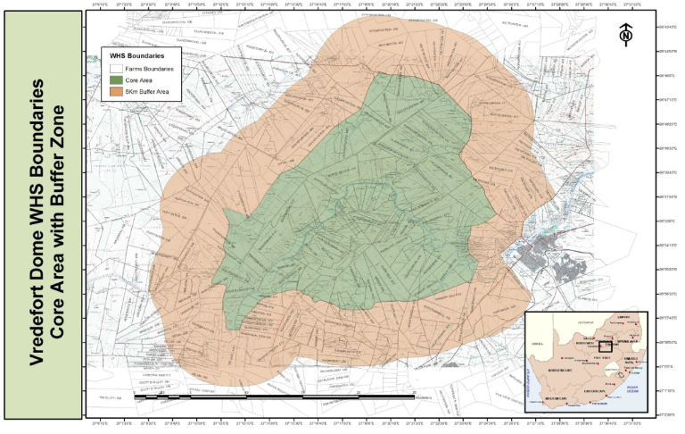
One of the most striking aspects of the Dome is the arrangement of its hills and ridges. These form subtle arcs and curves that hint at the immense scale of the original impact crater. When viewed from elevated points, the land appears to ripple outward, echoing the energy that once surged through the Earth’s crust. These formations are the result of rock layers being tilted, folded, and uplifted during the rebound that followed the meteorite strike.
The valleys of the Dome tell another part of the story. Over millions of years, water carved paths through fractured rock, creating channels that reveal layers formed deep beneath the surface. The contrast between darker and lighter rock bands reflects different geological eras, each layer preserving information about the conditions under which it formed. These exposed sections allow scientists and visitors alike to observe processes that would normally remain hidden far below ground.
The Vaal River plays a key role in shaping the Dome’s landscape. Its winding course follows zones of weakness created by the ancient impact, flowing through the structure rather than cutting across it. Along its banks, visitors can see how water and geology interact, shaping ecosystems while slowly sculpting the land. The river adds movement and life to an otherwise ancient and still environment.
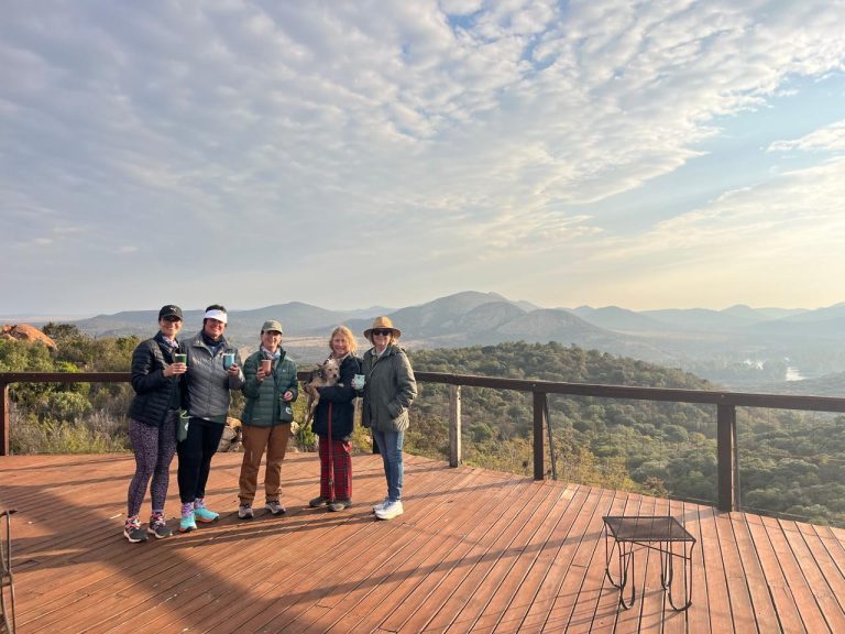
Natural viewpoints across the Dome offer moments of perspective and reflection. From these vantage points, visitors can better appreciate the scale of the structure and the harmony between geology and nature.
Hiking trails, farm roads, and scenic routes provide access to these areas, each offering a slightly different interpretation of the landscape.
Guided experiences can deepen this connection. Knowledgeable guides help translate what might otherwise appear as ordinary hills and rocks into meaningful geological features. By pointing out fault lines, tilted strata, and impact-related formations, guides help visitors see the invisible forces that shaped the terrain.
Reading the landscape of the Vredefort Dome is not about rushing from one viewpoint to another. It is about learning to notice patterns, textures, and shapes. The reward is a deeper understanding of how Earth records its own history, written not in words, but in stone.
Images provided by Michelle Storm.